Presently, a passenger ferry service on the middle arm of the Fraser River is a pipe dream, whispered in a few City of Richmond master plans for the area. But it may soon become a reality, especially in a decade when development of the waterfront truly takes shape.
Imagine, if you will, leaving your car at home, taking a bus or bicycle to the City Centre area and hopping on a ferry to take you to lunch at the Flying Beaver restaurant. Or, perhaps, take in the sights on the new Pier 73 patio, overlooking Moray Channel Bridge.
Vancouver residents may also choose to access the new outlet mall, BCIT campus or south terminal at YVR by exiting the Canada Line at Aberdeen Station, walking two minutes to the Cambie Road pier and boarding a ferry. Or, they may board a ferry on the Marpole side of the river, which is scheduled for densification.
Burkeville residents would arguably benefit the most in this new reality, where they would have direct pedestrian access to the Richmond Olympic Oval, the Canada Line, a planned hotel and entertainment zone in Bridgeport Village and the River Rock Casino and Resort.
The concept is predicated on the city’s plan to densify the City Centre. Once a critical mass of population is achieved and planned amenities — such as a circuitous walking path around the middle arm — are established, a bustling waterfront will be born and capable of supporting a ferry operation, according to Mike Redpath, senior parks manager for the City of Richmond.
While Redpath’s department has yet to consult with a ferry operator, False Creek Ferries operations manager Jeremy Patterson told the Richmond News there are several factors to consider; the most important one is having the local population and demand to run an unsubsidized, private service. One of his company’s biggest challenges is getting by in the winter. He said a ferry system could operate seasonally as a tourist attraction, but it would be hard to notify the public when the service opens each year.
Ferries would be authorized by Transport Canada and Patterson noted other river users — namely members of the UBC Rowhouse — would need to be consulted.
“The rowers left (False) Creek for the river because it was too busy down here,” he said.
With recreational boating on the river being promoted by the city, the ferry service would need to navigate amidst the likes of rowers and kayakers, although it would be difficult to reach the level of traffic found in False Creek, said Patterson.
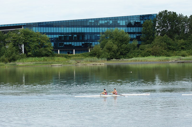
Furthermore, ferries on the river will have to battle tides and a fast flowing river, as opposed to the relatively calmer False Creek, so the boats may need more power, added Patterson.
Ferry service is not new to Richmond as a car/passenger ferry ran from south Richmond to Ladner, until the George Massey tunnel helped discontinue such service in 1959.
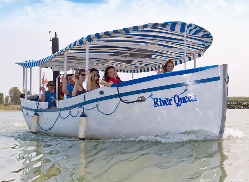
Meanwhile, the City of Richmond, Gulf of Georgia Cannery and Vancouver Whale Watch have teamed up this summer to offer a tourist-focused Sunday passenger ferry service in Steveston Channel. The River Queen ferry runs from Britannia Shipyards to Fisherman’s Wharf hourly from 10:35 a.m. to 4:35 p.m.
Middle arm to become city’s face
For longtime Terra Nova resident Dave Holt, who frequently walks on the Middle Arm Dyke trail, everything looks good so far for the Middle Arm Open Space Master Plan Concept (click here for full document) devised in 2004 by the City of Richmond’s parks department.
“Well, here, this was all covered in prickly bushes. We had to hack through them,” said Holt, pointing to a cleared dyke path that’s now been planted with native flora.
Holt, now retired, remembers days long ago when a small beach, just west of where the No.2 Road Bridge is now, played host to scores of residents on hot summer days.
The relics of the beach are now mud, having been washed away by the tides; but it is recreational activities such as that which the city hopes to revive.
“For too long, the city’s had its back to the river. This plan hopes to make the river its face,” explained senior parks manager Mike Redpath, who noted the plan’s guiding principle is to engage people with the river.
It starts with the city’s already existing asset — the dyke. The well-established West Dyke trail meets Terra Nova where an educational farm and new playground bring visitors. Moving east, residents can walk or cycle along a two-kilometre portion of dyke — that’s been raised to prepare for sea level rise — all the way to the Richmond Olympic Oval, where, last month, the city completed a $250,000 improvement to the riverfront plaza, by adding beach volleyball courts and a small playground.
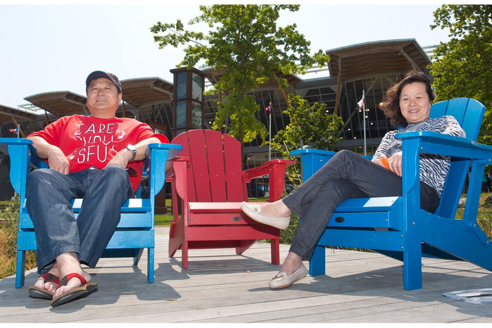
Here, a picnic on the grass awaits, or, perhaps, a moment of rest and reflection in one of the recenty placed Adirondack chairs overlooking the river on one of the new dyke-front decks.
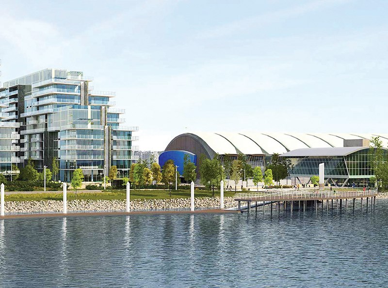
East of the Oval, developers plan to literally raise the earth across a half-kilometre stretch. Much like the Oval’s plaza, Aspac Developments will raise its planned River Green Phase 2 and 3 dyke-front residential complexes to come level with the dyke by 2023, burying the existing River Road for good.
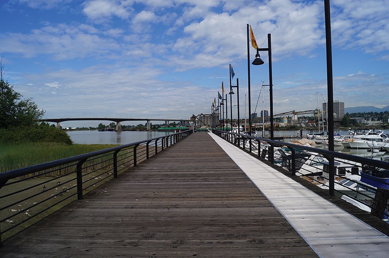
In addition to the $2.9 million “Oval East” waterfront upgrade, which includes two public walkways through River Green and a small greenway along Gilbert Road, a new $1.4 million public pier, mostly paid for by the developer, will be constructed next year at the foot of Hollybridge Way.
Immediately east of the Dinsmore Bridge will be the middle arm’s crown jewel, the one-kilometre long Middle Arm Waterfront Park. So far, the city has bought 11 acres of commercial-light industrial land for $30 million and it is still negotiating for another 17 acres.
Redpath’s parks department will elevate and re-landscape the area to include a large festival field, a native forest and wetland and an observation hill for rowing and Dragon Boat competitions. Along the water will be stepped, rock seating, presently in place in some parts.
The park will stop short of Cambie Road, where Canada Post owns and operates a sorting facility. The plan calls for development of that site into a “cultural / shopping destination” next to another public plaza.
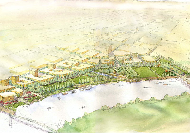
Moving people to and from the park will be a new, $11 million, four-lane arterial road, River Parkway, that will replace River Road north of the Dinsmore Bridge and extend to Capstan Way. Phased construction, paid for through developments fronting the road to the east, is scheduled to begin in 2018 and the full build-out is expected by 2028, when about 90,000 people are expected to be living in City Centre.
The Middle Arm Greenway, as it will be known, will connect the largely residential zones of the Terra Nova, Oval and Minoru neighbourhoods to the waterfront residential-maritime “mews” of newly dubbed Capstan Village, as well as the newly dubbed, business-oriented Bridgeport Village that plans to feature an international trade centre, hotels and an “entertainment” zone. There may also be an opportunity for “waterborne residential.”
The area is expected to take on an eclectic feel, on par with Granville Island, according to the plan.
Redpath said the city still has work to do in planning how to connect the greenway to the River Rock Casino and Resort marina, but the plan is for an environmentally upgraded, natural setting overlooking the river’s bend.
However, pedestrian and cycling access points will ultimately be moulded from the city’s map and the greenway will serve as a connection between the West Dyke, Railway Greenway, the City Centre and north arm cycling routes, including the Canada Line pedestrian bridge.


