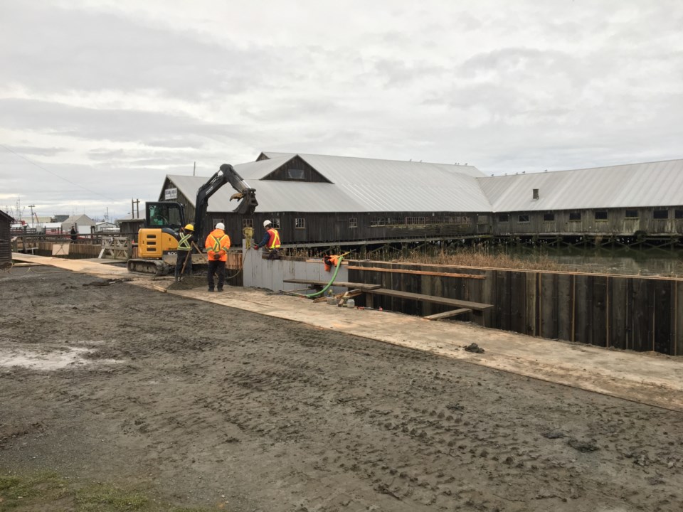
The finishing touches are being put on a new flood wall at Britannia Shipyards, that should protect a city park and various historic buildings from water damage during king tides and storm surges.
Unbeknown to the naked eye, the Britannia site falls outside of the city’s dike system. The dike exists behind it, as Westwater Drive, and then loops behind an adjacent condo development, then connects to the Steveston boardwalk at Railway Avenue. Outside of that zone is susceptible to occasional flooding, such as a large flood in March 2016 that sent City of Richmond crews sandbagging.
Now, city officials have constructed an estimated 250-metre, water-tight wall from the Chinese Bunkhouse to the Phoenix Gill Net Loft. While the dike is at least 3.5-metres above mean sea level, the new wall is only 2.9 metres, up from 2.4 metres.
The wall will protect the likes of the Murakami Boatworks, Men’s Bunkhouse, Point House and Cannery Office, as well as a large green space used for the Maritime Festival.
The wall is made of plastic sheets. Wooden cladding on either side helps maintain the heritage appeal of the site. However, the wall will be incomplete as to allow walkways from land to historic buildings beyond the wall, propped up on pilings. In the event of a king tide or heavy storm, city crews will install custom, light-weight metal panels to shore up the gaps at each opening.
An opening will also be left at an old alder tree to protect its root system.
Meanwhile those buildings beyond the wall, such as the Seine Net Loft — which have historic artefacts in them — will be left unprotected. As such, during high water events, Britannia site staff have plans to move artefacts out of harm’s way.
Full restoration of the park is expected by this spring.
Wall plugs a small chink in the armour
The project is said to be part of the city’s 2017 Drainage and Diking Utility budget of $11.6 million.
By 2100, the city is targeting a complete dike system of 4.7 metres (above present day mean sea level), as sea levels are expected to rise 1.0 metres due to global warming as Lulu Island concurrently subsides, or sinks, another 20 centimetres.
According to the city’s Fraser River Freshet and Flood Protection Update 2017, the city has 49 kilometres of dikes. Keeping Richmond dry are 581 kilometer of drainage pipes, 61 kilometers of culverts, and 165 kilometers of watercourses (sloughs and ditches). The city’s drainage and flood protection system is currently valued at an estimated $1.451 billion.
The city has continued to increase its pumping capacity as well, as urban development and less green space puts more pressure on the sewer system.
A new, $4.4 million No. 2 Road pump station is among the newer tools set to come online soon, as it is presently under construction.


