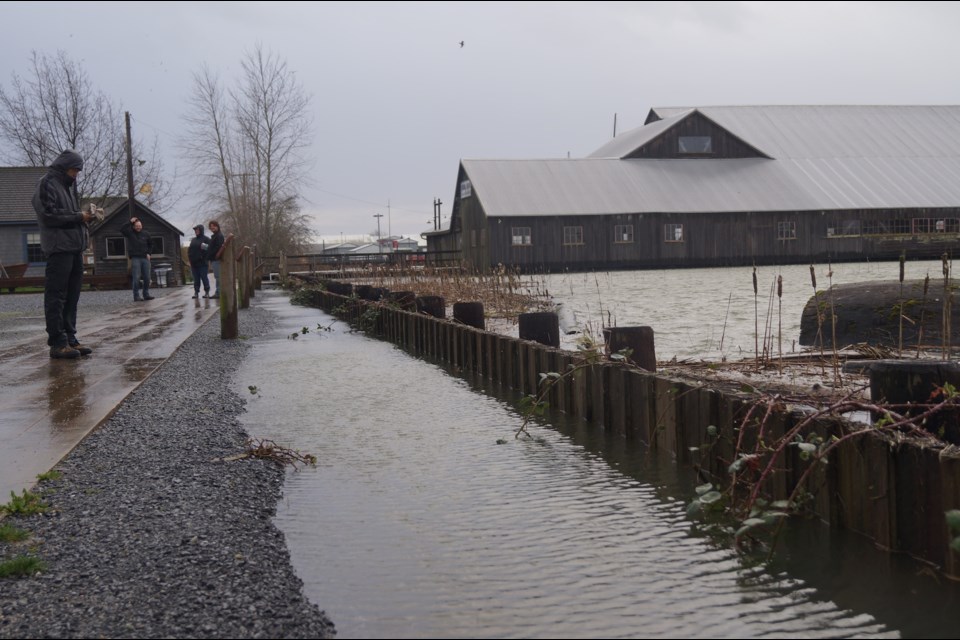
Britannia Shipyards National Historic Site and the adjacent boardwalk experienced flooding Thursday morning.
Due to high tides and a storm surge, the Fraser River came within inches of covering the entire site, although much of it was covered in the early hours of the day. Water entered some of the site’s buildings and also poured onto Westwater Drive, closing the local road for most of the morning. The Murakami House garden was also flooded.
By the afternoon, the city stated it was assessing the potential damage.
Local flooding in #Steveston #RichmondBC . . . Get well soon, @BritShipyards pic.twitter.com/fxhWuzxSTe
— Richmond News (@TheRichmondNews) March 10, 2016
Britannia is outside of the dyke (Westwater Drive) and is prone to flooding during extreme weather, noted City of Richmond spokesperson Ted Townsend.
In 2013 the city drafted a long-term $109 million flood protection plan. The plan involves building a higher dyke along Shady Island and connecting it to Gilbert Beach to the east and Garry Point to the west. Both ends will have a sea gate to allow for boats to enter and exit the harbour and to facilitate water flow.
The plan also calls for raising the historic structures that are presently resting over water.
Barriers (sea berms) may also be built along Sturgeon Bank to mitigate waves.
The plan is viable for projected sea level rise of about one metre up to 100 years from now.
Complex geotechnical and hydrological studies are required to see the plan through.
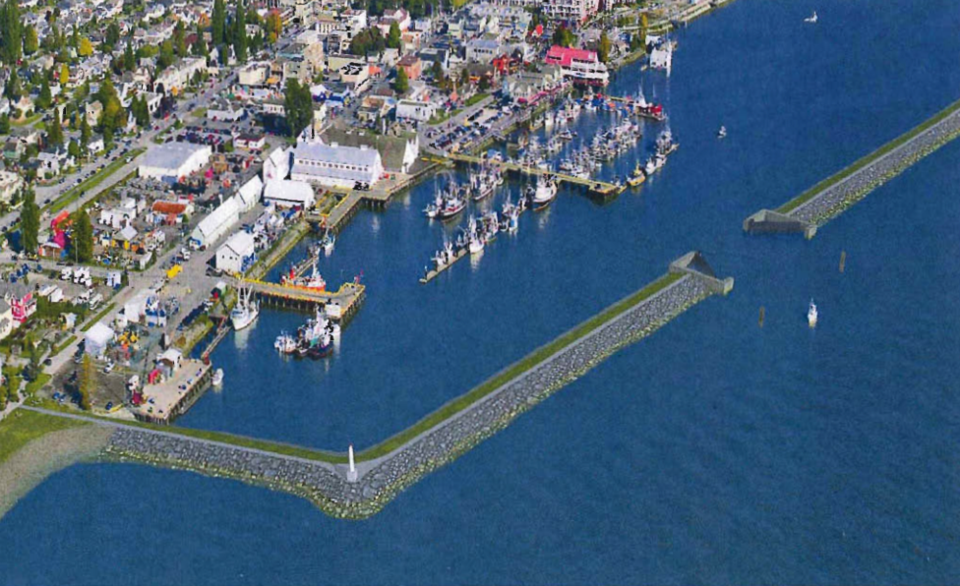
Steveston Master Dike Plan Phase 1


