Plans to build a 3.3-kilometre long dike for flood protection from London Landing to Garry Point Park – encompassing Shady Island – is back on the table.
The flood protection plan was proposed three years ago, and $1.2 million was spent on preliminary plans.
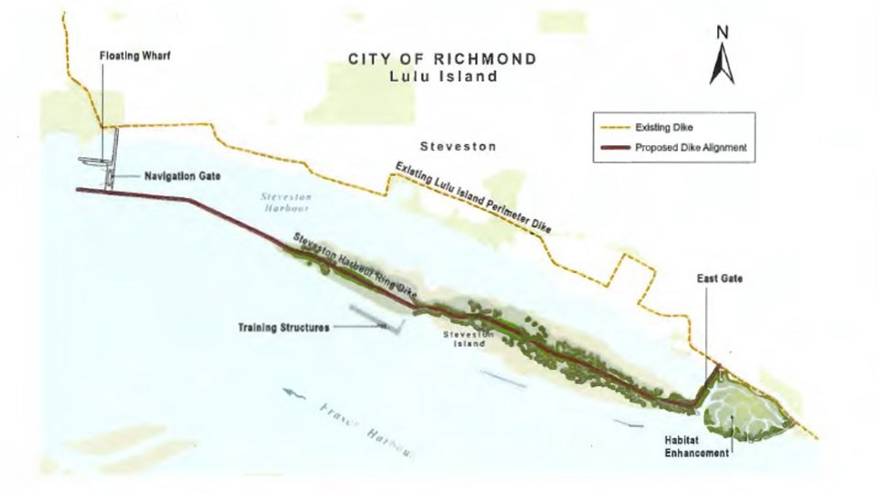
The dike would enclose Steveston Harbour and would include gates at the east and west ends, which would be closed during high water events.
The dike would start at London Landing, cross the water and continue along the length of Shady Island and beyond, then curve back to Garry Point Park.
When the city created its dike master plan, the need to protect Steveston was identified as a priority. However, building a dike along the Steveston waterfront would have disrupted businesses and residences and wouldn’t have protected historical sites such as the Gulf of Georgia Cannery.
City staff are now planning to consult with the public and stakeholders on the project.
Next steps include completing the second phase of the preliminary design, talking with the province about negotiating land tenure on Shady Island – also called Steveston Island – working on the environmental assessment and looking for funding from senior levels of government.
The dike plan is on the agenda for Monday's committee meeting.


