The storm that just passed through Richmond this week was the biggest the city has seen in a half a century.
This had city crews working overtime to ensure all pump stations were functioning properly and fielding about 380 calls from residents with flooding and water issues.
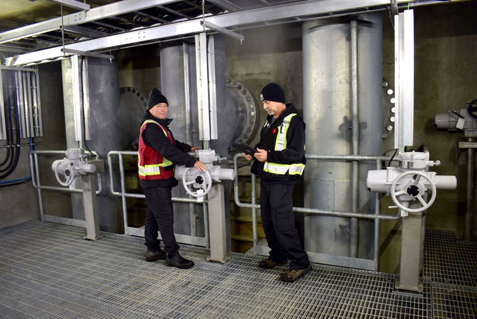
The only thing keeping Richmond from flooding during a rain storm such as this is a network of 49 kilometres of dykes and 39 pump stations, which can collectively expel a million gallons of water per minute.
Ditches, canals, sloughs, and 600 kilometres of storm sewers and box culverts are also part of the city’s flood-control system.
Other parts of the province haven’t fared as well during the storm that meteorologists are calling an “atmospheric river.”
Many highways across southern B.C. remain closed due to washouts and mudslides and the entire town of Merritt is on evacuation order because of a failed wastewater treatment plant, rendering their water undrinkable.
Closer to home, the Sumas Prairie area in Abbotsford — a lake that was converted to farmland — is being evacuated.
The “imminent failure” of one of its pump stations poses a “significant risk to life,” according to a statement Tuesday from Mike Farnworth, Minister of Public Safety and Solicitor General.
Jason Ho, manager of engineering planning with the City of Richmond, said the importance of the city’s extensive drainage and dyking system can be summed up by a quote from one of his predecessors: “No dykes, no Richmond.”
“We’re protecting $100 billion in assets in Richmond,” Ho added.
Richmond’s geography one metre above sea level and its waterfront locale means it faces both current threats —rainfall, the spring freshet and storm surges — as well as future threats — sea level rise as well as more intense storms, of which this week is an example.
This makes the city, with the Fraser River on one side and the sea on the other, especially vulnerable, Ho said.
In fact, in response to the threat of rising sea levels, which could possibly cause the dykes to breach and cause Hurricane Katrina-style devastation, Richmond city council shortened the timeline of its dyke building program by 25 years.
(In 2005, Hurricane Katrina caused widespread flooding in New Orleans, with 1,800 casualties and $150 billion in damage after its dykes broke.)
The goal is to raise all Richmond dykes to four to five metres above sea level within 50 years (the original timeline was75 years).
But this isn’t a cheap endeavour.
Richmond has applied for $38 million in federal funding for dyke upgrades, the biggest one-time ask they’ve put forward so far.
Over the past decade, Richmond has received about $40 million in senior government grants.
If successful, this will allow the city to move faster on upgrading pump stations and fortifying and raising the dykes.
While senior levels of government provide some funding, a regular stream of money comes via utility fees, paid for by Richmondites.
So, when Richmond homeowners open their property tax bills next spring, they can expect to see an average increase of $8 to $18 on their draining and dyking utility fees (this is higher for business owners). This will help expedite raising the dykes and upgrading the pumping equipment.
Global meets local
Richmond got between 118 and 138 millimetres of rain over three days — amounts not seen in half a century.
In fact, it was a major storm in 1948 resulting in widespread flooding that motived the municipality to dyke its perimeter.
At the time, Richmond was primarily a fishing and farming community. Areas such as west Steveston used to be mainly farmland but are now filled with homes and paved driveways, explained Simon Kras, a senior project manager with WSP, an engineering company that has worked with the City of Richmond on its dyking program.
So, when there’s a heavy rainfall, there is significantly less soil to absorb the water, which can then flood the drainage system. Despite that, Richmond continues to urbanize and densify, leading to more impervious surfaces, creating yet greater reliance on the city’s pump and dyking infrastructure.
Residents generally take for granted infrastructure if it’s working as it should, explained Kras.
“The dyke is a perfect example of that — if it wasn’t working, there would be an uproar,” Kras said.
While the dykes are a municipal responsibility — overseen by a provincial inspector of dykes— the rising of the seas is a global phenomenon.
Because the earth’s atmosphere is warming, glaciers are melting and the ocean water volume is expanding as it warms up —both of these are causing sea levels to rise.
Scientific estimates are that sea levels will rise one metre by the year 2100, while the city is expected to sink 20 centimetres over the same time period. Existing dykes are being raised to 4.7 metres in anticipation of this sea level rise while new ones are being built to a height of 5.5 metres.
But rising sea levels aren’t the only threat to Richmond’s dyking system.
A major earthquake could also cause a breach of the dyke, but fortifying the entire 49 kilometres of dyking is cost prohibitive, Kras said, so the city has focused on fortifying around the pump stations. Since 2005, the city’s ability to deal with water has increased by 29 per cent.
The city’s engineering department said it is anticipating the effects of climate change, and this is why it continues to upgrade its drainage system to prepare for more “large rainfall events.”
Given climate change, though, the question remains whether the city’s timeline is tight enough.


