The snowpack across British Columbia is far lower than average, after a warmer and drier winter so far.
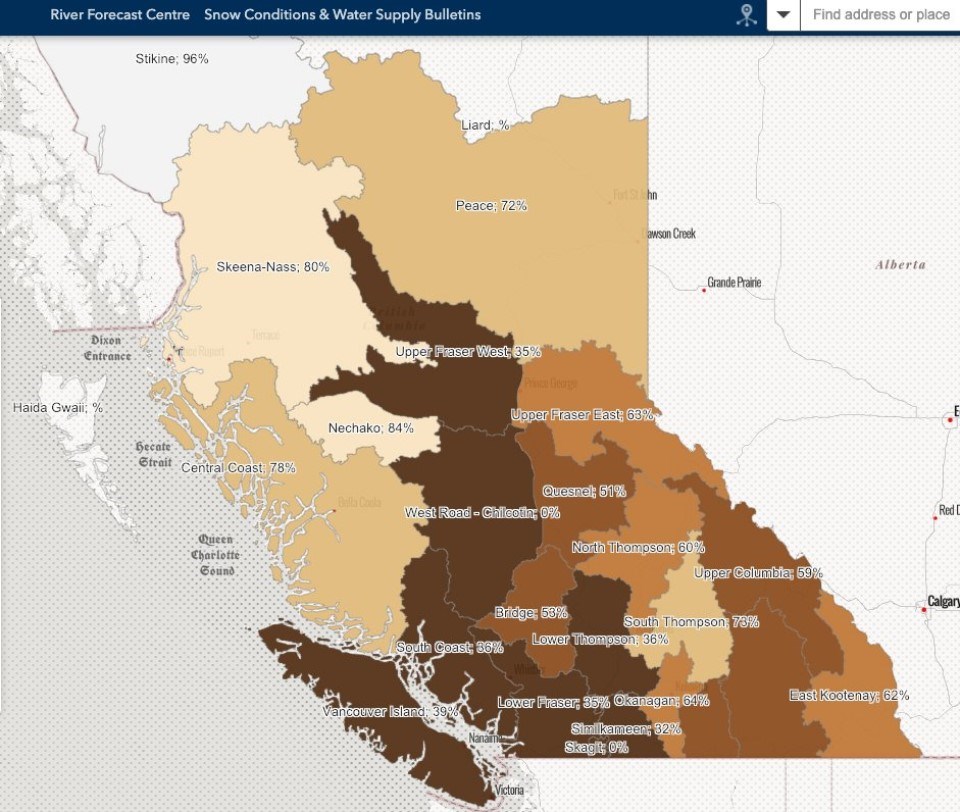
According to data released by B.C.'s River Forecast Centre Wednesday, the "Snow Basin Index" across the Okanagan is 64% of normal, but many regions are far lower.
While significant snow has fallen across the province in recent days, the River Forecast Centre's recent Snow and Water Supply Bulletin only includes data up to Jan. 1.
To the south, the Similkameen region is at just 32% of normal, while the Lower Thompson region is at 36%. The South Thompson region currently has a snowpack that's 73% of normal, while the the North Thompson is at 60%.
Some regions, like the Skagit and West Road-Chilcotin regions have zero snowpack.
This year's winter is far different from a year ago. During the same time in the Okanagan, the snowpack was at 135% of normal.
It's been an abnormally dry and milder winter so far this year, due in part to a particularly strong El Niño effect.
“The seasonal snow accumulation season got off to a slow start this year,” the RiverForecast Centre said in a report last week.
“Overall, October was generally drier and warmer than normal. The same trend continued for November with a long period of unusually dry conditions for British Columbia in the second half of the month. A couple strong Atmospheric River events affected the southern portions of the province in early December and then again on Christmas Day and resulted in brief uptick in some snow stations. Temperatures for December were very warm for the month.”


