Tuesday 6:30 a.m.
The Cariboo Regional District downgraded several evacuation orders down to alerts Monday night, allowing residents to go home but remain ready to leave if conditions worsen.
The evacuation orders for the Lhoosk'uz area, Pelican Lake, Townsend Creek and a portion of the Teepee Lake order have been downgraded to alerts.
The CRD has issued a guide for evacuated residents returning home.
There are still significant dangers not only from wildfire smoke in the air but also from livestock and wildlife on the roads and unstable trees in fire-damaged areas.
Saturday 8 a.m.
An evacuation order was issued late Friday by the Cariboo Regional District for a massive section of the Central Interior, covering 333, 972 hectares, southwest of Prince George, south of Vanderhoof and west of Quesnel.
Combined with the adjoining Pelican Lake and Teepee Lake evacuation orders, the total size of the region affected is 520,000 hectares (5,200 square kilometres), an area only slightly smaller than the province of Prince Edward Island.
In Friday's order, residents in the Lhoosk'uz area were told to immediately leave and make their way to the Prince George Emergency Service Centre located at the Kin Centre.
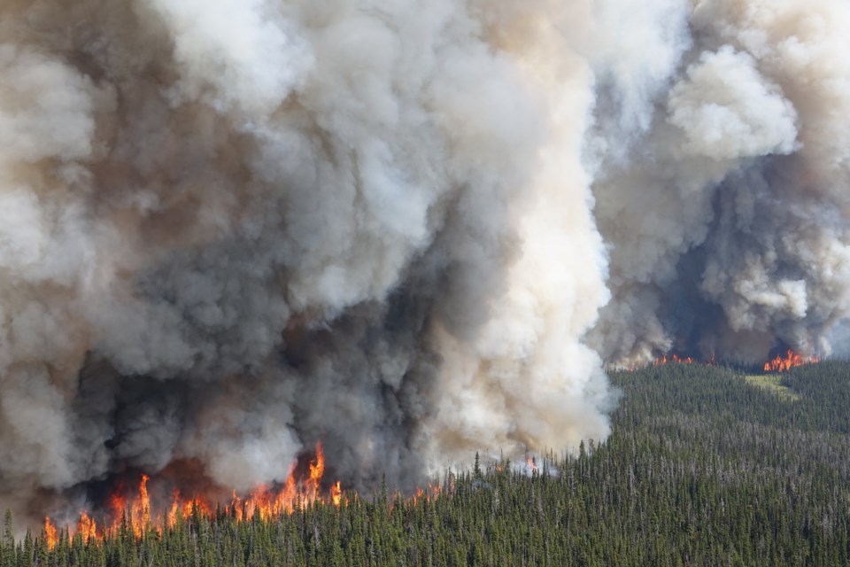
There are seven wildfires of note in that area, according to the B.C. Wildfire Service.
The Nithi Mountain fire is not far from Highway 16, south of Fraser Lake, and Nadleh Whut’en First Nation has put its residents living on reserve and in Lejac on an evacuation alert.
The others include the Greer Creek fire, the Finger Lake fire on Sai’kuz First Nation territory, the Pelican Lake fire, the Teepee Lake fire, the Townsend Creek fire, the Davidson Creek fire and Gatcho Lake fire.


